Safe & Fast APK Downloads on APKPure
APKPure uses signature verification to ensure virus-free Yacht Navigator | Kartenplotte APK downloads for you.
The yacht Navigator turns your tablet into a powerful plotter.
With the Yacht Navigator, you can easily and intuitively use your tablet or smartphone as a chartplotter in real time. The Yacht Navigator app is based on the maps of the printed inland and nautical charts of the Delius Klasing publishing house.
App including free sample card set. More card sets are available via in-app purchase.
THE MOST IMPORTANT FUNCTIONS
Sheet-cut, sliding map display
Offline navigation (only the internet maps are needed to download the maps)
Compass (COG) as digital and analog display
Intelligent direction finding tool (one-finger operation possible)
TRACKING FUNCTION
Recording and displaying the driven route
Selection of different colors to clearly distinguish the tracks
Always reachable button to quickly start and stop the recording
Display detailed information (such as distance traveled or maximum speed) for the track
Background tracking
ROUTE FUNCTION
Easy and comfortable planning of routes
Visual support when driving off routes
Display of the bearing to the next waypoint in the compass
Automatic change to the next waypoint when driving off a route
Dynamic display of remaining travel time and arrival time
MORE FUNCTIONS
Positioning in the map: Internal (GPS, mobile network)
Simple continuous zooming of the card (one-finger operation possible)
Personalization of the desired display values (SOG, POS, etc.)
Right / left-handed mode for optimized, personalized operation
Presentation of the driven course as well as an advance vector in the map
Extrapolation of fuel consumption when driving off a route
MAPS
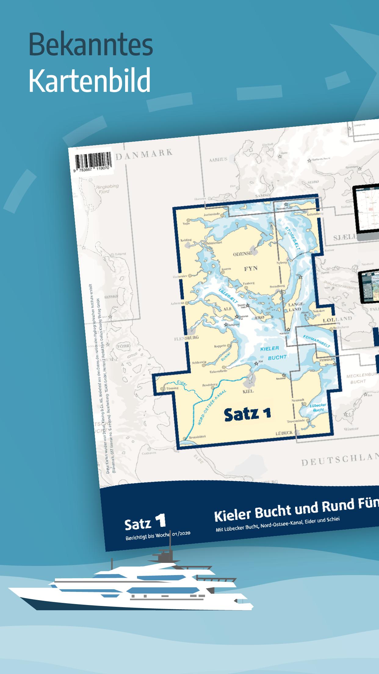
The digital Delius Klasing sports boat maps are tailored to the special needs of pleasure boating. Cheap scales, a clear color code and a clear presentation are the main advantages of the nautical maps for these areas. Especially with these digital maps, the exact position accuracy plays an important role.
The entire coastline of the respective area is recorded on the largest possible scale, at least 1: 50,000. For trips in the open sea area, there is at least one practical over-sailing card in every set of maps, and detailed maps in various high-resolution scales for nautically demanding areas. This high scale variety allows the skipper to always display the correct image area of the maps on the screen.
The different depth ranges are graded in color in the maps in 2, 4 and 5 m ranges, so that on the one hand shoals and on the other hand the safe navigable depth ranges can be detected at first sight. In addition, the particularly important 2 m or 3 m depth line is highlighted in red. Floating navigation marks are colored and thus easy to identify. As is customary worldwide with all nautical charts, the international names of the identifiers and beacons are used in the Delius Klasing card sets.
As far as possible, the Delius Klasing recreational boat maps are drawn up on the basis of the official map data of the national hydrographic institutes.


One-click to install XAPK/APK files on Android!
Thanks for your rating and feedback!
You have already rated.